As Colorado grows, protecting what makes our home special is vital.
Join us in conserving the land and water that unite us.
A trail completely circling Pikes Peak has been a long-held dream for the residents of and visitors to the Pikes Peak region. The vision was originally documented in the 1999 Pikes Peak Multi-Use Plan, a collaboration between multiple agencies which, among other topics, designated a Perimeter Loop Trail around the Pikes Peak massif. Through the efforts of our local government agencies and dedicated nonprofit organizations, nearly 70% of the trail has been completed over the last 20 years. As it stands today, a hiker can travel 50 miles along the Ring the Peak Trail using a mix of singletrack trails, service roads, and paved roads. However, there is no way to currently circumnavigate the entire mountain due to two missing links - the northeastern flank and the southwestern flank. El Paso County is addressing the northeastern gap with the design and construction of the Ute Pass Regional Trail, but it has been a bit more challenging to find a solution to the southwestern gap.
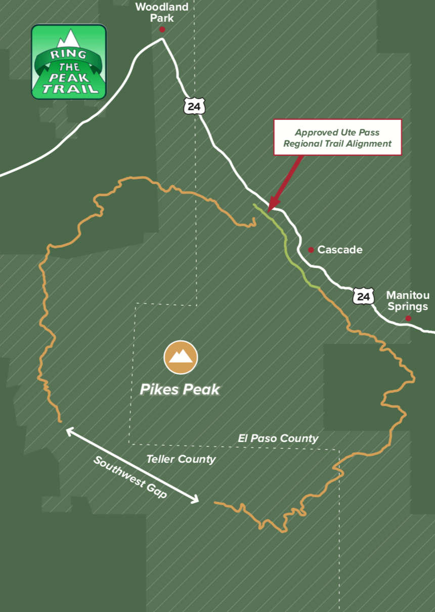
Considering multi-jurisdictional and private land ownership, critical water reservoirs, important bighorn sheep habitat, and incredibly rugged terrain, a trail spanning the eight-mile gap on the southwestern flank of the Pikes Peak massif is no easy feat. However, through a partnership of key stakeholders and with the assistance of Great Outdoors Colorado, a Master Plan for completion of the southwestern gap has been completed. The Master Plan identifies a tentative trail alignment and provides the community a roadmap for completion. The Ring the Peak Trail will provide our region with world-class hiking, biking, and backcountry camping; a draw for national and international visitors; and an economic boost to the neighboring communities. Palmer is thrilled to be a part of this visionary process and hope you will support the effort to complete this trail.